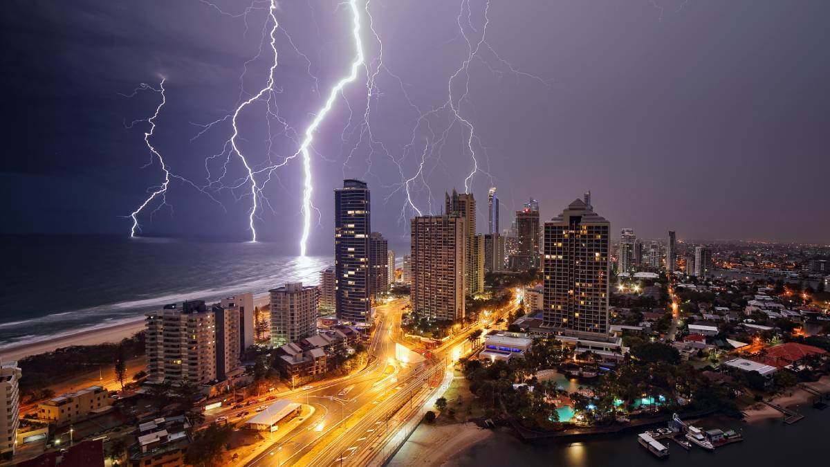
Australian weather has always been prone to extremes, which is why the sunburnt country is known for its drought and flooding rains.
When the Bureau of Meteorology (BOM) declared an El Niño event in September, there were warnings of a hot and dry summer.
But for thousands of Queenslanders especially — from the storm-ravaged south-east to the flooded Far North — that’s not been the case at all.
Why has this summer been so wet?
Climate experts say it’s a combination of misconception surrounding El Niño and several climate drivers that are contributing to wetter conditions.
Research director for the CSIRO’s Climate Intelligence program, Dr Jaci Brown, likened El Niño’s behaviour to a chocolate pinwheel.
“Without any forecast, there is an equal chance it could be a wet, dry or normal year,” Dr Brown said.
“So when we know it’s going to be an El Niño it changes that probability so the segment for dry conditions on that chocolate wheel is much larger, and the wet is smaller”.
Professor Andrew Dowdy from the University of Melbourne said often it’s believed storms were related to climate patterns, but that’s not the case.
“It doesn’t mean it is always hot and dry, but it does mean that in some regions and seasons of the year there is an increased chance of hot and dry conditions,” Prof. Dowdy said.
“It is just a higher probability we can see those conditions arise”.
Why are there so many storms? Isn’t that La Niña?
Storms and thunderstorms are a completely different kettle of fish.
Several factors have been triggering increased rain and thunderstorms along the east coast, but the main driver is the relatively warm sea surface temperatures (SSTs) near eastern Australia.
“Warm SSTs can sometimes lead to increased water vapour in the air that can cause more rain and increased moisture for thunderstorm occurrence. In turn, that can cause very intense rainfall and flooding in some cases,” Prof. Dowdy said.
The BOM also noted the presence of a positive Southern Annular Mode (SAM) combined with very high SSTs in the Tasman Sea contributed to the rainfall events.
“It is unusual to see a persistently positive SAM during El Niño as that is more typical during a La Niña phase,” a BOM spokesperson said.
Why do different parts of Australia experience El Niño differently?
Over the past month, while Queensland faced record-breaking rainfall, South Australia and Western Queensland sweated through heatwave conditions as bushfires burned in the west.
Dr Brown attributed the variation of El Niño experiences across the country to an average of hot and dry conditions and not a totality.
“When we talk about dry conditions from an El Niño, it’s not dry everywhere – it’s dry on average,” Dr Brown said.
“The reality is every El Niño is different, there isn’t a set pattern of how they’re going to behave, so each year is a new experience.
“Typically the Murray-Darling Basin area is usually most related to El Niño conditions and along the coastline it’s actually less prevalent.”
Is climate change to blame?
On Tuesday, Senator Murray Watt attributed the severe weather that’s been observed in Queensland’s south-east to climate change.
“We need to remember with climate change we’re going to be seeing more of these extreme weather events than we have in the past,” Senator Watt said.
In short, El Niño is not a result of climate change, but its tendency to exhibit extreme conditions could be an outcome.
“We have done decades of research, we know El Niño and La Niña will still happen, but it’s not completely clear the impact climate change has,” Dr Brown said.
“Will it make the events more extreme? Will it dampen them? Will they be more frequent?”
A recent study published in the scientific journal Hydrology and Earth System Sciences into the influences of climate change on extreme rainfall found for each degree of global warming, an 8 to 15 per cent increase of extreme rain should be accounted for.
Since pre-industrial times, the planet is 1°C warmer on average.
So what’s the outlook for the rest of the season?
The BOM has projected the January to March forecast to still see an increased chance for above median rainfall to parts of south-east Queensland, eastern NSW and Victoria.
But there’s also the chance of “neutral rainfall” over the interior and southern parts of the country.
“Chances favour drier than average conditions for most of WA, parts of the NT and some parts of Queensland,” a BOM spokesperson said.
 2020 Australian Broadcasting Corporation. All rights reserved.
ABC Content Disclaimer

